Historic Images of Antietam and Its Centennial Anniversary
Antietam Battlefield Guide Gary Rohrer recently found some of these historic images of Antietam in the Western Maryland Room at the Washington County Free Library. We post them here for all of you to see, as well as Gary’s memories of the Centennial Anniversary of the Battle of Antietam in 1962:
Gary’s 1962 Badge and a 1962 Centennial Program
“I’ve told the tired old stories of my Boy Scout days at Antietam National Battlefield and my enthusiastic participation at the Centennial Celebration lasting from Aug 31 to Sept 17, 1962. It would be the last reenactment to take place on the battlefield. Not long ago, I was going through some boyhood trinkets that I found in a box and much to my surprise was the concessions badge (left) that I was required to wear while passing out Official Programs in front of the Dunker Church. Last year, I was able to track down an original copy of the program from a dealer in Gettysburg (left).
I remember the reconstruction and dedication of the Dunker Church, the Clara Barton Monument, and finding the Texas monument on Cornfield Avenue when I came home on Christmas break from my first year in college. I remember driving over Burnside bridge just before it closed to vehicular traffic and the countless times in my youth that we drove over the bridge with the monuments on the corners. Of course, I’ve mentioned many times about my Boy Scout experiences camping in the area of the Final Attack and hearing great stories by E. Russell Hicks while sitting around the bonfires with several hundred Boy Scouts. That, along with a similar experience at Crampton’s Gap (needless to say) ignited my interest in the 1862 Maryland Campaign.”

This photo is after 1920 because we see the NY State Monument in the background.
Branch Ave – Note the Sherrick Barn in the background and the dry laid stone fence in the foreground
The Norfolk & Western Railroad monument along Shepherdstown Pike, west of the Antietam Train Station

Napoleons located on either side of Cornfield Ave

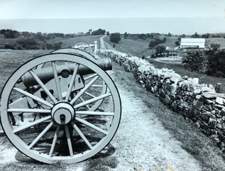
The Sunken Rd before the relocation of Richardson Ave. Note the concrete fence posts.
Help Preserve 44 Acres at Antietam!
A historic opportunity has arose to purchase and protect 44 acres at Antietam. The Civil War Trust has recently launched a capital campaign to raise the necessary funds to purchase the Wilson Farm. This is no ordinary tract of land, however. Though the buildings are not historic to the Battle, the fields surrounding the house and barn are located at the heart of the morning action at Antietam. Throughout the entire morning, those 44 acres saw wave after wave of attacks and counter-attacks across the land. The triangular parcel of land is arguably the bloodiest of the entire day. To learn more about the efforts to save 44 acres at Antietam, and to donate to the Civil War Trust to help in the cause, visit the Trust’s website: http://www.civilwar.org/battlefields/antietam/antietam-2015/
The Civil War Trust has also produced a fantastic video describing the fighting that took place on and around those 44 acres:
War Department – Antietam: The Epicenter of the Battlefield from Civil War Trust on Vimeo.
Antietam 151: Anniversary Weekend
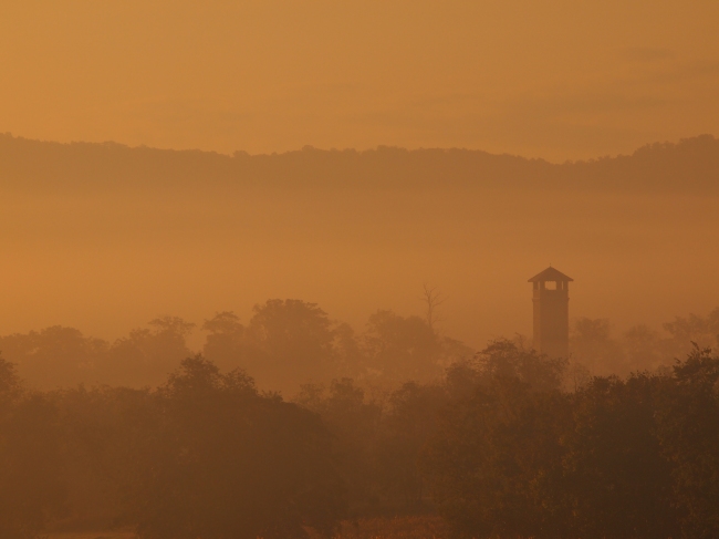
Anniversary morning 9/17/12.
Photo by Dave Maher
It’s hard to believe it has been a year already. The Antietam Battlefield Guides hope to see you all out on the Battlefield this weekend enjoying another year of great National Park Service commemorative programs. For a complete schedule of Anniversary events, check out Antietam National Battlefield’s weekend schedule by clicking the image above.

